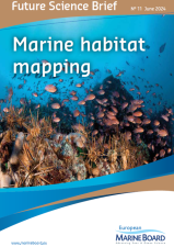
海洋栖息地测绘——使用建模方法结合数据制作地图
准确而全面的海洋栖息地地图对于支持各种海洋政策和目标至关重要,包括欧盟海洋战略框架指令和实现欧洲绿色协议雄心勃勃计划的政策。然而,仍有大片地区尚未绘制地图,目前的地图主要关注海洋栖息地的物理方面,缺乏足够的生物学分辨率,例如物种和群落。
需要更高分辨率的地图来更好地表示三维海床和水柱之间的联系,并实现从时间的“第四维”考虑海洋环境的生态系统方法。EMB 未来科学简报第 11 期“海洋栖息地测绘”介绍了推进下一代海洋栖息地测绘的科学和政策需求和建议。
本文件重点介绍了通过遥感和直接现场 技术从海底和水柱获取数据的当前方法和未来趋势。它讨论了使用建模方法结合数据制作地图,并提出了采用适合用途的栖息地分类方案的建议。它还概述了欧洲海盆内已绘制的内容和位置,强调需要提高海洋栖息地地图的质量和分辨率。它确定了栖息地类型和地理范围的关键差距,包括沿海地区、深海、Natura 2000 地点和所有区域海域的其他海洋保护区。最后,它描述了改进对地图不确定性和可信度的评估和交流的必要性,并使各种利益相关者更容易获取地图,以增加其对最终用户和公众海洋素养的价值。
emb_fsb11_marine_habitat_mapping_we… 下载链接:https://pan.baidu.com/s/1fNORIpBJlGj3yezp2MpCTQ HYZY

———————————————————————————
英文原文:
Marine habitat mapping
Accurate and extensive marine habitat maps are fundamental to support a wide variety of marine policies and ambitions including the EU Marine Strategy Framework Directive and policies to deliver the ambitious plans of the European Green Deal. However, large areas remain unmapped, and current maps predominantly focus on physical aspects of marine habitats and lack sufficient biological resolution, such as species and communities.
Higher resolution maps are needed to better represent the linkages between the seabed and water column in three-dimensions and to enable an ecosystem approach that considers the marine environment in the “fourth dimension” of time. EMB Future Science Brief No. 11 ‘Marine habitat mapping’ presents science and policy needs and recommendations to advance next-generation marine habitat mapping.
This document highlights current methods and future trends in the acquisition of data from the seabed and water column via remote sensing and direct, in situ techniques. It discusses combining data to produce maps using modelling approaches and presents recommendations for adopting fit-for-purpose habitat classification schemes. It also provides an overview of what has been mapped and where within the European sea-basins, highlights the need to increase the quality and resolution of marine habitat maps. It identifies critical gaps in habitat types and geographic extent, including the coastal areas, the deep sea, Natura 2000 sites and other Marine Protected Areas across all regional seas. Finally, it describes the need to improve the assessment and communication of uncertainty and confidence in maps, and to make maps more easily accessible to a variety of stakeholders to increase their value for end-users and to the public for Ocean literacy.
